
CRAB (Climate-economy Regional Agent-Based model) is a spatially-explicit economic agent-based model that simulates how a regional economy reshapes itself under the interplay between agglomeration forces and climate hazards. On the one hand, agglomeration acts as a pull: economic benefits, and amenities draw households and firms toward attractive locations. On the other hand, climate hazards act as a push: shocks damage assets and erode the desirability of exposed areas. CRAB captures how these opposing forces, and the policies that mediate them, jointly determine where people and firms locate, how vulnerability accumulates, and how adaptation benefits evolve over time. This addresses a gap in conventional economic models, which tend to treat these dimensions in isolation or too simplistically, obscuring feedback that can lead to maladaptation. The model can be applied at different spatial scales, from a single NUTS-3 region up to an entire country.
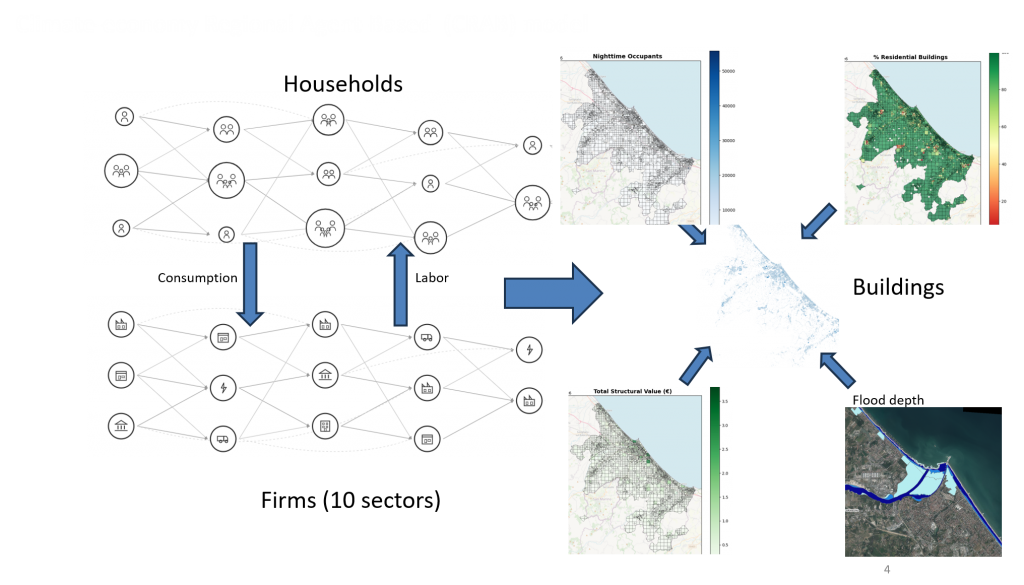
The model populates a region with heterogeneous households and firms spanning ten broad sectors of the NACE Rev. 2 classification, distributed across neighborhoods and physical buildings of three different classes. Each quarterly time step resolves four interlinked markets: a property market (two-step auction with neighborhood choice driven by affordability, amenities, and endogenous risk awareness), goods and capital markets (decentralized competitiveness-based matching with input-output linkages), a labor market (two-sided matching on wages, commuting, and education). Endogenous demographics govern household births, deaths, splitting, migration, as well as firm entry and exit.
Stochastic shocks (floods and heat) whose frequency scales with regional temperature, inflicts damage and shape a memory-decay process of risk awareness, which feeds back into location choice and prices. Adaptation operates at two levels: households and firms can invest in private protective measures, while the government can deploy public defences that reduce flood depth. These feedback loops link climate shocks, the property market, and population dynamics—allowing analysis of adaptation and development policies across public/private and top-down/bottom-up scales. CRAB can also be coupled bidirectionally with the RICE50+ integrated assessment model.
CRAB is a data-intensive agent-based model. It builds its synthetic population from GLOPOP-S micro-data and takes building exposure and structural value from the GFZ European Building Exposure Dataset. JRC Flood hazard maps and depth-damage functions are used to calculate individual building exposure. Neighborhood attractiveness is calibrated from property prices and OpenStreetMap amenities, while economic relationships—including input-output tables and import/export dependencies—are drawn from national statistics provided by Eurostat. Because these inputs are pan-European and harmonized, the model is readily relocatable to any NUTS-3 region or country in Europe.
Website: Github: https://github.com/witch-team/CRAB
Related working paper: link.